Researching at the Boston Public Library
Overview

The Leventhal Map & Education Center is a nonprofit organization established as a public-private partnership between the Library and philanthropist Norman Leventhal. The Leventhal collection has 200,000 maps and 5,000 atlases and a website that includes more than 10,000 digitized maps. The map collection is global in scope, dating from the 15th century to the present, with a particular strength in maps and atlases from the New England region, American Revolutionary War period, nautical charts, and world urban centers.
Collection Overview
LMEC's collection emphasizes objects whose geographic extent includes Boston, Massachusetts, and New England but they have objects from all over the globe. LMEC also holds many thousands of maps produced by federal, state, and local governments, as well as from agencies related to defense, environmental management, and urban and regional planning.
LMEC has three defined areas of expertise: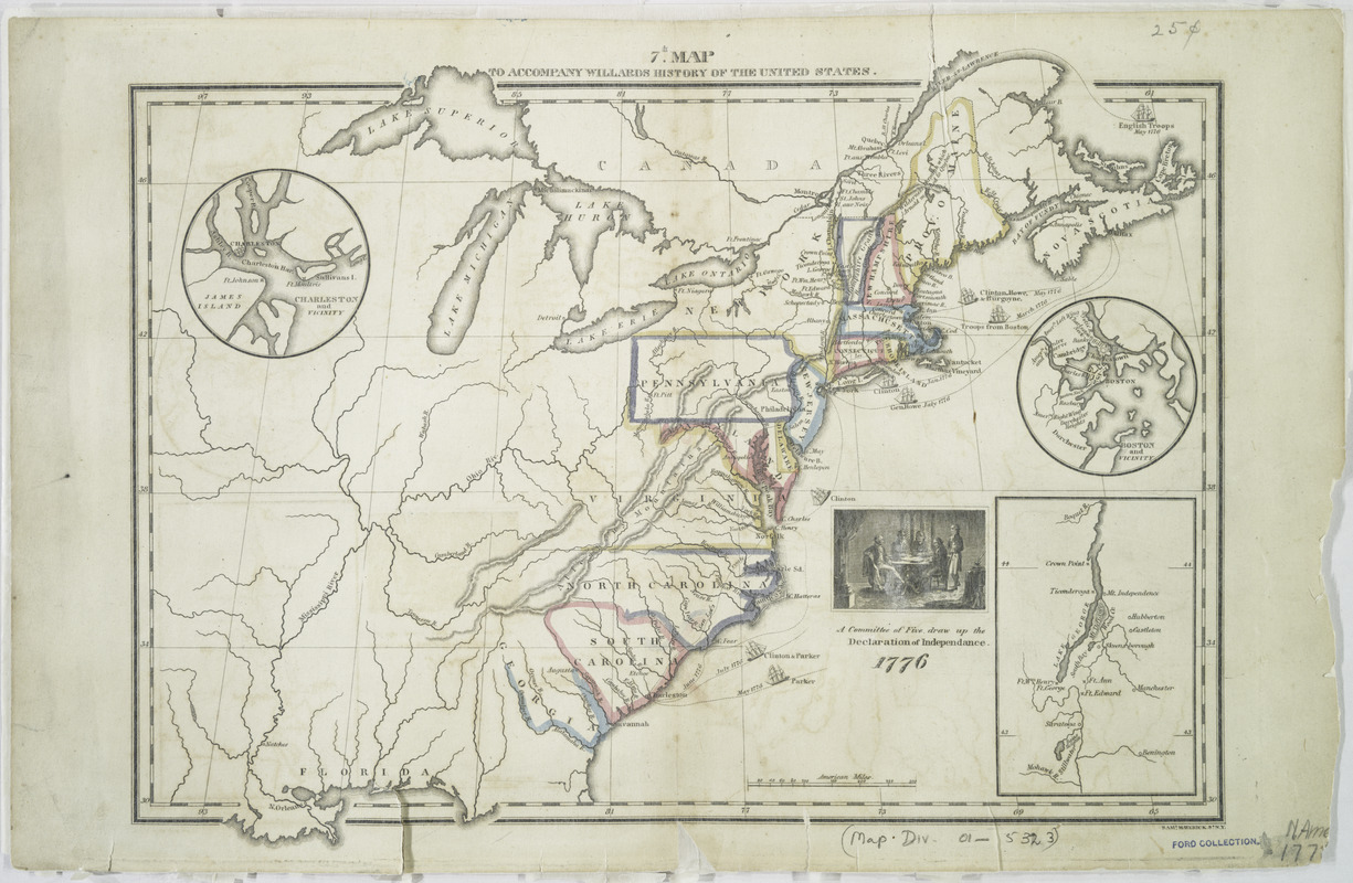
Collections of Distinction
Each collection contains hundreds or thousands of items. Patrons may see these items in person or online - they are digitized!
- American Revolutionary War-Era Maps
- Boston and New England
- Urban Maps
- Maritime Charts and Atlases
Right: 7th map to accompany Willards History of the United States, from the American Revolutionary War-Era Maps collection
The Mapping Boston Collection
This collection consists of the rare maps collected by Norman B. Leventhal during his lifetime. The maps in this collection range from fifteenth century world maps produced during the Age of Exploration to many of the most important maps of Boston and New England in the colonial period and early republic.
Data Collections
LMEC collects data sets and geospatial information pertaining to both present-day and historical geography. They also collect geographic information that is derived from physical objects, including both identifying data such as bounding boxes as well as inferred data such as names, boundaries, and characteristics. See also Geospatial Information Services.
Accessing LMEC Collections & Services
 LMEC holdings are cataloged in BPL's catalog (bpl.org). There are two ways to search for only LMEC materials:
- Do an Advanced Search on bpl.org. In the "Held at" dropdown menu, select BPL - Leventhal Map Center. Add any preferred keywords in the search box and run the search.
- LMEC did "Advanced Search" work for you and provided a search box on their website: www.leventhalmap.org/collections/searching/
Digital Collections
 The Leventhal Map & Education Center has one of the most significant digital collections of any North American map library. Thousands of maps and images are available for free digital viewing. LMEC materials are mainly available on two online repositories, both of which are free to access without registration:
- Digital Collections portal. Nearly 10,000 objects, primarily flat maps but also including some bound atlases, ephemera, and series, are available on our Digital Collections portal. The Digital Collections portal features an advanced search for filtering material by date and theme, as well as many maps that have been georeferenced for display on top of a modern map layer.
- Internet Archive. Over 300 atlases and books, consisting of bound format, non-oversize materials, are scanned and uploaded.
Digitization Projects
LMEC creates digital research tools such as interactive maps and exploration tools. See their webpage (leventhalmap.org/projects/digital-projects) for full descriptions. These tools help researchers explore Greater Boston with historical maps, data-driven maps, annotated maps, georeferencing maps, and more.
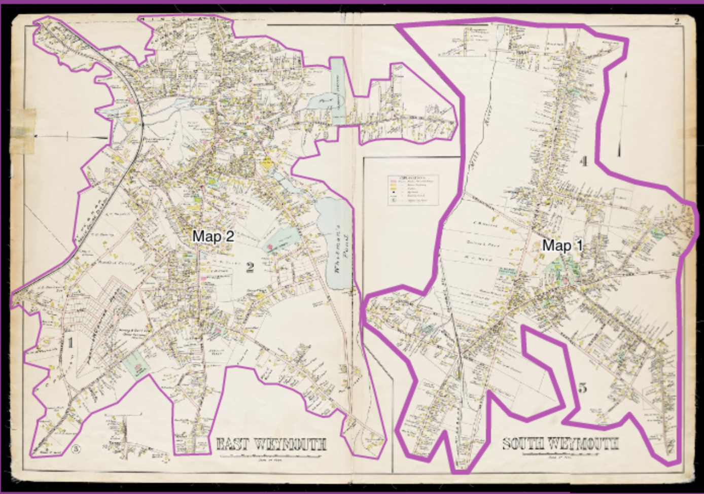
Right: A screenshot showing two examples of LMEC digital projects
Leventhal Map & Education Center always has two exhibitions on display which can be viewed in-person or digitally.
 LMEC's permanent exhibit is entitled Becoming Boston: Eight Moments in the Geography of a Changing City. It follows eight themes in the historical geography of Boston: A Collision of Worlds, From an Oceanic Empire to a New Nation, The Town That Couldn’t Contain Itself, An Industrious Era, Managing a Modern City, A Patchwork Quilt of People, Resistance and Resilience, and Making Tomorrow’s City Together.
The rotating exhibit changes every 6-12 months. See past exhibitions here: www.leventhalmap.org/exhibitions/past-exhibitions/
Visiting the Gallery
The LMEC gallery is free to the public, and no advance booking is necessary to view exhibitions. Plan to set aside between 30 minutes and 1½ hours for a full experience in the Gallery. The Gallery features captions and activities for children and families as well as adults.
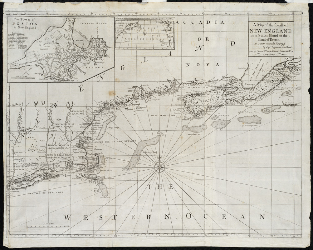
Right: A map of the coast of New England, from Staten Island to the island of Breton, 1737. From Becoming Boston exhibition.
 LMEC offers geospatial information services to help you create, find, manipulate and preserve information stored in digital formats compatible with mapping software and GIS (Geographic Information Systems). Specific services include:
- Cartinal, a guides & documentation portal;
- A robust data portal with special focus on Boston & New England;
- One-on-one consultations with geospatial library staff.
Read more about these services and make an appointment with LMEC staff on their GIS webpage: leventhalmap.org/research/geospatial
Right: an image from Cartinal, LMEC's portal for guidance and tutorials
LMEC's archival collections include personal papers of cartographers, records of mapping or surveying firms, and subject-based collections. They have nine distinct collections:
 Applied Geographics, Inc. Records: Maps dated 1982-2012 that were created by or held by Applied Geographics, Inc., a GIS consulting firm in Boston.
- Auctioneer Plans Collection: Auctioneer plans advertising lots to be auctioned for sale, usually by cities or real estate companies.
- Robert Bayard Bellamy Surveying Papers: Primarily surveys of properties in eastern Massachusetts circa 1860-1950, with the bulk of surveys done approximately 1890-1930. The majority of surveys are by Robert Bayard Bellamy (1879-1962).
- C.L. Berger & Sons Records: Documents and objects produced by the surveying instrument manufacturing company from 1919-1948.
- Dana F. Perkins, Inc. Surveying Records: Surveys, notebooks, and ancillary surveying documents from firms and individual surveyors acquired by the company, as well as some surveys created by Dana F. Perkins, Inc.
- Richard K. Grady Papers: Primarily work notes and maps produced by the American geographic information systems professional and cartographer Richard K. Grady (1955-) or by the companies for which he worked.
- Annie Olmstead Peet Papers: Manuscripts, pre-production and published pictorial maps produced from 1926-1969 by cartographer Annie Olmstead Peet (1888-1973) of Rochester, New York.
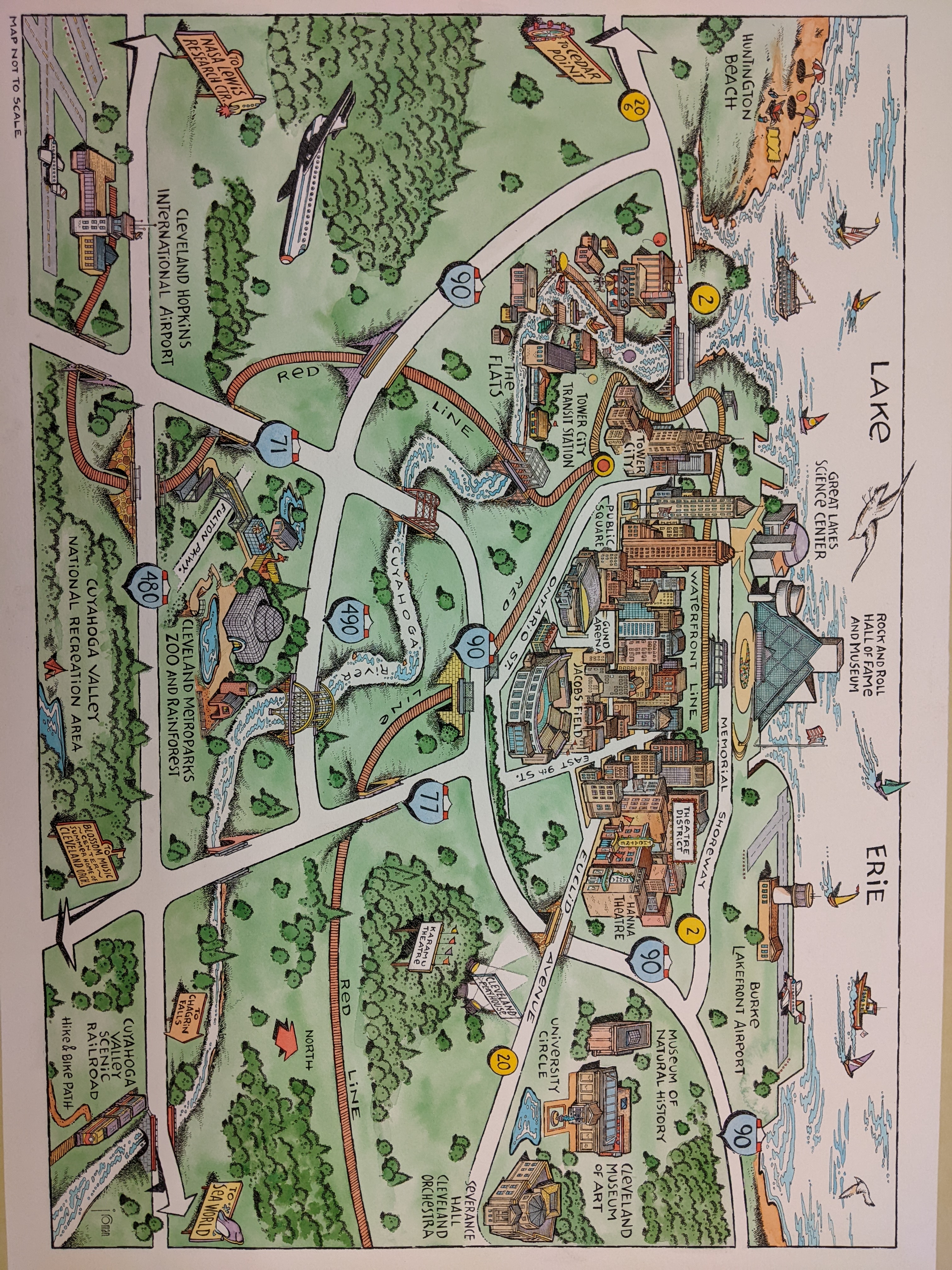
- John Roman Papers: Pictorial maps produced from 1984-2012 by John Roman (1950-), an American map illustrator, author, and college art professor.
- David Judkins Weaver Papers: Primarily maps dated 1799-2019, bulk 1970-2019, that were created or collected by David Judkins Weaver (1951-2024), a cartographer and geographer in Boston, who worked at various companies and Massachusetts agencies from the early use of computer cartography in the 1970s through its development and increasing adoption to prevalent method of cartography in the 2010s.
Full descriptions of each collection are provided online as well as finding aids. Reach out to LMEC staff to request to view items in-person.
Top right: Manuscript pictorial map of Cleveland, Ohio in ink and watercolor by John Roman